(short preview of full seamless looping track)
(short preview of full seamless looping track)
(short preview of full seamless looping track)
(short preview of full seamless looping track)
(short preview of full seamless looping track)
Karl-Liebknecht-Straße
This product is not available in the selected currency.
In Stock
Backordered
Out of Stock
Description
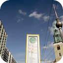
The long road rumbles with the caroling of the day's economy. A catwalk of pedestrians, vehicles, and the occasional odd sight, this contemporary german causeway swims with a cross-section of the city's self. You stand on the street corner, watching the citizens hustle, and wonder where they can find the energy to even ambulate this early in the morning. Karl-Liebknecht-Straße is a major street in the German capital Berlin, Mitte district. It is named after one of the founders of the Communist Party of Germany, Karl Liebknecht. It connects the boulevard Unter den Linden with the arterial road Prenzlauer Allee, leading to the northern border of the city. Although part of the street dates back to the earliest times of the city, most of the buildings at its side were built in the 1960s, when East Berlin's center was redesigned as capital of socialist East Germany. The origins of the street lie in the north of Berlin's historic center. There were three alleys that went from the New Marketplace and St. Mary's Church at the northern end of the town down to the river Spree. They had had different names over the centuries and were ultimately known as Papenstraße (“bishops street”, named for a branch of the Bishopric of Havelberg), Brauhausstraße (“brewpub street”) and Kleine Burgstraße (“castle street”, named for the Stadtschloss on the other side of the river). Since the 16th century, a wooden bridge, known as Sechserbrücke (“sixpence bridge”), would lead across the water to Spree Island near the eastern terminus of Unter den Linden.
Opps
Sorry, it looks like some products are not available in selected quantity.


